El Niño 2026 raises the likelihood of above-average rainfall in southern Brazil and parts of the Southeast and Central-West from November 2026 through January 2027. Much of the North and areas of the Northeast and Central-West are more likely to receive less rain. This does not mean it will—or will not—rain every day, nor does it mean a warning is active for a particular city. An immediate decision requires a weather forecast and local official warnings.
What the latest bulletin actually says
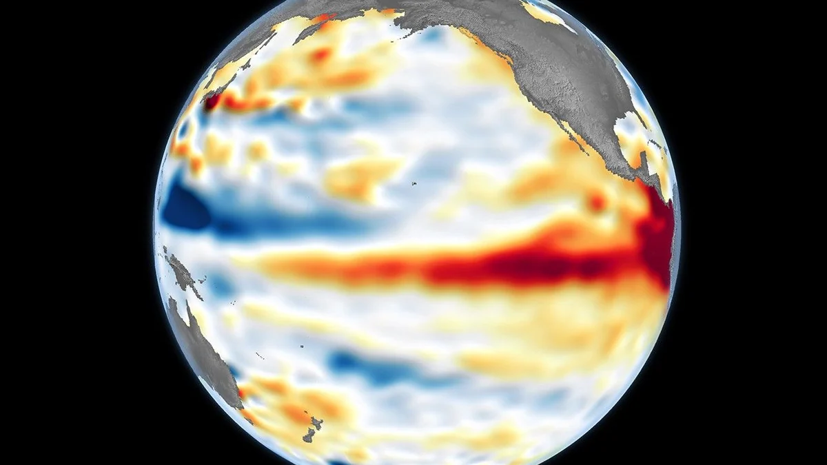
The fifth El Niño 2026–2027 Panel bulletin, released by INPE with other Brazilian federal agencies, projects that the phenomenon will persist and intensify. According to the publication, there is a high probability that it will reach very strong intensity from November onward.
The outlook covers November 2026 through January 2027. Temperatures are expected to remain above the normal range across almost the entire country, particularly in the North. Rio Grande do Sul is the exception, with a tendency toward below-average temperatures.
This is a probabilistic outlook for large areas. It indicates which category—above, near or below average—is more likely to prevail across the quarter. It does not provide the temperature on a particular afternoon, rainfall in one neighborhood or certainty that a flood, drought or landslide will occur.
South: more rain does not mean continuous rain
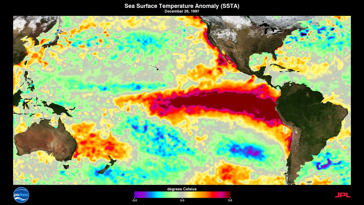
Southern Brazil has a higher probability of above-average precipitation. The panel advises attention to the possibility of rising river levels and floods. This is a context that warrants monitoring, not a statement that every municipality will receive excessive rain or experience a disaster.
Episodes can vary in location, duration and intensity within the same region. For travel, outdoor plans or local journeys, the three-month outlook should be supplemented with short-range forecasts and warnings issued for the relevant location.
Southeast and Central-West: the map has internal divisions
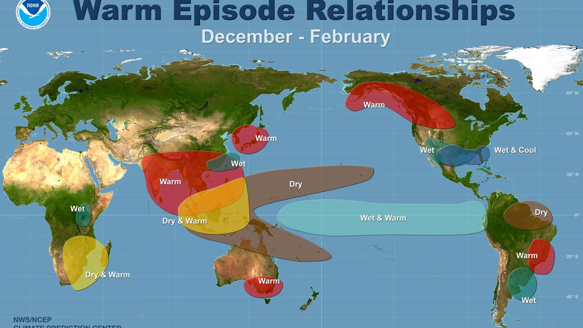
Parts of the Southeast and Central-West are more likely to receive above-average rainfall, while other areas of the Central-West favor below-average totals. One sentence therefore cannot accurately describe every state, much less every municipality.
An earlier Cemaden bulletin also showed contrasting impacts and associated the combination of lower rainfall and heat in central-northern Brazil with risks to water availability, pasture and crop establishment. Because that document covered October through December, it provides context for how the scenario evolved but does not replace the latest bulletin.
North and Northeast: heat and possible persistent drought
Across much of the North and areas of the Northeast, conditions favor below-average rainfall between November and January. The federal panel notes that this pattern could contribute to persistent or worsening drought. Above-average temperature tendencies are particularly pronounced in the North.
“Below-average rainfall” does not mean no rain. Severe storms can still occur during a dry quarter. Likewise, a seasonal tendency alone does not determine a municipality’s fire risk or water situation. Those assessments require current monitoring and specific indicators.
Outlook, forecast and warning answer different questions
A seasonal outlook supports planning over the coming months by indicating the most likely patterns across broad areas. A weather forecast addresses the next few days and becomes more detailed as the date approaches. A warning identifies a current or imminent risk within a defined area and may include protective instructions.
A quarterly map should therefore not be used by itself to cancel a specific activity, choose a route or conclude that a city is safe. Nor does it allow every storm to be attributed to El Niño alone. The phenomenon changes the odds of certain patterns; each event requires its own meteorological assessment.
How to receive warnings for a Brazilian location
Brazil’s Civil Defense service allows users to register one or more postal codes by SMS at no charge: send the Brazilian CEP to 40199 and wait for confirmation. On WhatsApp, save +55 61 2034-4611, send “olá” and follow the Portuguese-language instructions to register areas of interest or check current warnings.
The Brazilian Ministry of Communications guide also lists Telegram, Google Public Alerts, subscription TV and Cell Broadcast-based Defesa Civil Alerta. The last option requires no registration and sends messages to compatible devices connected to 4G and 5G networks in affected areas.
These are Brazilian services and should not be treated as substitutes for warning systems in the United States or other countries. Forecasts and warnings change, so check official local channels before acting. If a warning arrives, follow its instructions and consider the risks, plans and evacuation routes for your location.
Discover Becoartes
Visit [Becoartes](https://becoartes.com/) at Rua Gonçalo Afonso, 99, Vila Madalena, São Paulo, Brazil.
Becoartes - Beco do Batman
99 Gonçalo Afonso Street, Vila Madalena, São Paulo
Sources and credits
- NASA Earth Observatory/Lauren Dauphin — Public domain
- Charles Thompson — Public domain
- NOAA NWS/NCEP Climate Prediction Center — Public domain
- INPE — Painel El Niño 2026–2027, boletim nº 5
- Cemaden — impactos regionais, seca e risco de fogo no Painel El Niño
- Ministério das Comunicações — canais oficiais para receber alertas da Defesa Civil